Dragonfly Trails by the Numbers: 34 Miles, 500,000 Users a Year and a 65-Mile Master Plan That Has Built 9 New Miles for $17 Million
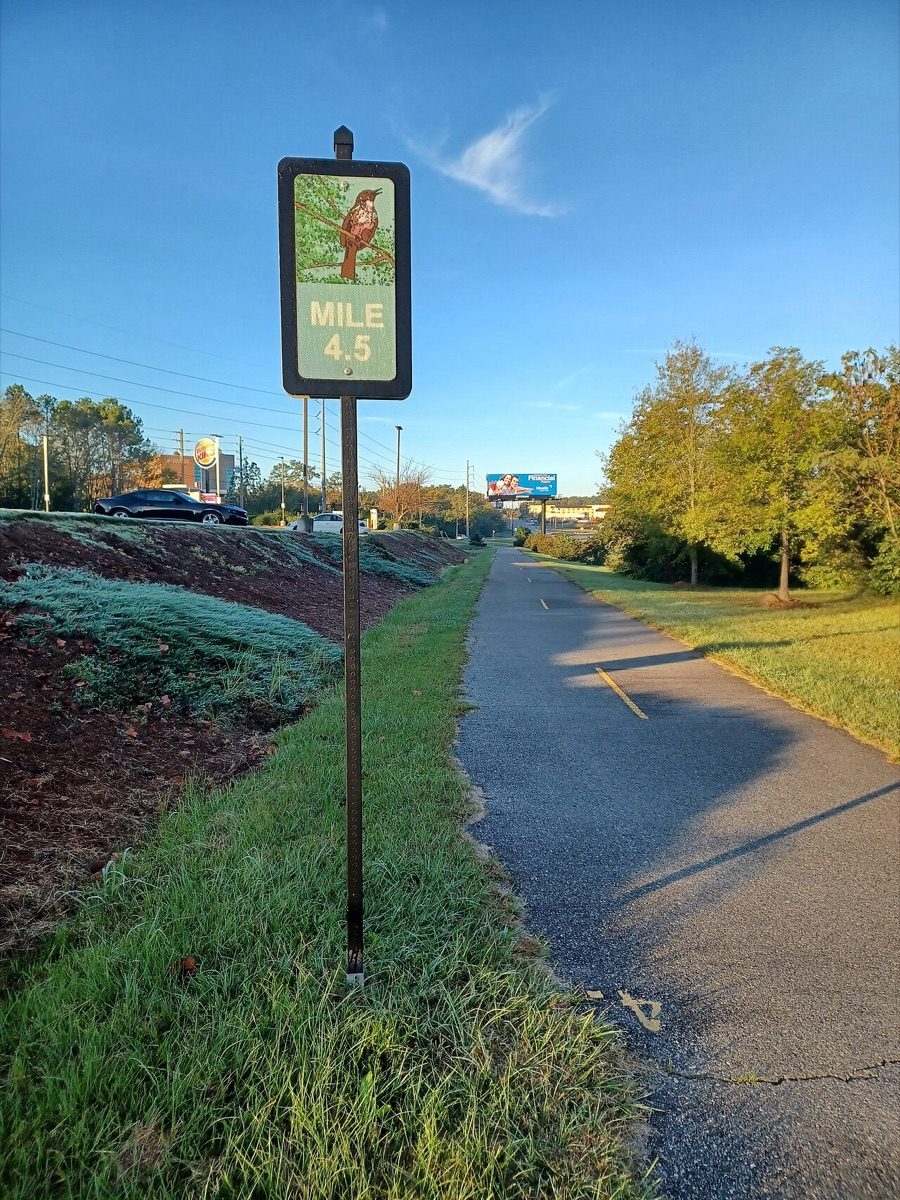
A Fall Line Trace mile marker, 4.5, in Columbus, Georgia. Photo: Xnatedawgx / Wikimedia Commons (CC BY-SA 4.0)
COLUMBUS, Ga. - Columbus has about 34 miles of connected off-road trails, and more than 500,000 people use them each year, according to Dragonfly Trails Inc., the nonprofit that promotes the network. The system links neighborhoods, schools, jobs and the Chattahoochee River, and it is still growing toward a 65-mile master plan. The numbers below show what exists today, how each trail got its start and where the next miles are headed.
The network at a glance
Dragonfly Trails describes its system as interconnected, multi-use greenway trails for recreation and for getting around without a car. The trails are off-road, which separates them from the city streets. The group lists five existing trails and the year each one opened.
| Trail | Year opened | Length | Notes |
|---|---|---|---|
| Chattahoochee RiverWalk | 1996 | Varies by source | Runs along the river through downtown |
| Fall Line Trace | 2011 | About 10.5 to 11 miles | Rail-trail from Midland to the RiverWalk |
| Follow Me Trail | 2018 | About 2.6 miles | Rail-trail, according to TrailLink |
| MLK Trail | 2019 | About 1.9 miles | Parallels Martin Luther King Jr. Boulevard |
| 10th Street Connector | 2023 | About 1.5 miles | Links MLK Jr. Boulevard at 10th Avenue to the RiverWalk |
Trail lengths come from TrailLink and city documents, and they differ slightly between sources. TrailLink describes the network as 33.5 miles today, while Dragonfly Trails says 34. A Columbus council resolution that predates the latest additions put developed trails at 30.6 miles with a goal of 60, which shows how quickly the totals have moved. The 2023 opening date for the 10th Street Connector comes from the Dragonfly Trails site, and other documents describe that 1.5-mile link as nearing completion, so readers should check trail status before planning a route.
The 65-mile plan
In 2015, Dragonfly Trails partnered with the PATH Foundation and the Columbus Consolidated Government to adopt a 65-mile master plan, according to the nonprofit. The plan has 15 segments. The partnership has invested $17 million so far, which has produced five new connections spanning nine miles, according to Dragonfly Trails.
That works out to roughly $1.9 million per new mile. The nonprofit does not publish that figure. The division is only a rough average.
Trail by trail
The Fall Line Trace is a rail-trail that runs from Psalmond Road in Midland to the Chattahoochee RiverWalk in Columbus, according to TrailLink. Mile markers on the trail count its distance, and a former Georgia Midland and Gulf Railroad crossing at University Avenue is one of the reminders of its railroad past. TrailLink lists its length at 10.5 to 11 miles depending on the edition.
The MLK Trail runs from 10th Avenue to Roosevelt Avenue and MLK Boulevard, according to TrailLink, and parallels the boulevard for more than a mile and a half. The PATH Foundation's page for the Columbus Dragonfly Trail lists three segments of 12.2, 10.5 and 1.9 miles. It describes a greenway along the Chattahoochee River through north downtown that connects to the Fall Line Trace and to a southern side path along MLK Boulevard.
The RiverWalk, which opened in 1996, is the oldest piece of the system. TrailLink says it links the former mill village of Bibb City, downtown Columbus and the drill fields at Fort Benning. Its listed length has varied between 15 and 15.5 miles in TrailLink guides, so the figure depends on the edition and on where a source starts counting.
What is being built now
The city has advertised for a Dragonfly Trail segment along River Road, a concrete trail of about 5,026 linear feet, which is just under one mile, according to a public bid listing. Separately, a Dragonfly Trails planning document describes a 1.5-mile connector near completion that would link Uptown and Midtown. The listing and the document do not give opening dates, so the timing of both projects is unconfirmed.
Where to park and what to know
The PATH Foundation lists the Civic Center and the MLK Jr. Trailhead as major parking and access points. The trails are described as mostly flat, with few hills, a fair number of amenities and river views. For maintenance problems, PATH links a trail maintenance page on its site. Dragonfly Trails can be reached by mail at PO Box 266, Columbus, GA 31902.
Because trail segments are still being connected and some are under construction, a quick look at the nonprofit's site or a local trail map before a long ride is a good idea. Conditions and closures can change. The network is also growing, so the mileage in this guide may be out of date within a year.
Source: Dragonfly Trails Inc. (dragonflytrails.org); PATH Foundation (Columbus Dragonfly Trail); TrailLink (Fall Line Trace, Follow Me Trail, MLK Trail)
News organizations may republish this story with credit. See our guidelines.
Know someone who'd want to read this? Email it to a friend.
Plan your weekend with Columbus Times
Get This Weekend in Columbus every Thursday: the best local events, free things to do and family fun, plus each evening's local news. Free, and you can unsubscribe anytime.
By signing up you agree to get the Columbus Times email newsletter. Unsubscribe anytime with one click.
Comments
Be respectful. No personal attacks, hate speech, spam or anyone's private information. Every comment is reviewed before it appears. Comment rules
No comments yet. Be the first to share your thoughts.