Columbus RiverWalk: 34 Years of History, 22 Miles of Trails and the Transformation of 2 Cities
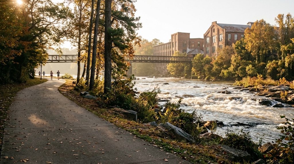
The Chattahoochee RiverWalk opened its first mile on Columbus Day 1992 and now runs 22 miles. Illustration: AI-generated
Columbus, Georgia, opened the first mile of its Chattahoochee RiverWalk on Oct. 12, 1992, beginning a transformation that eventually produced a 22-mile recreational corridor along the river. Across the water, Phenix City, Alabama, developed its own riverfront trail, creating a connected recreation area that links two cities, two states and generations of local history.
The RiverWalk did not begin as a conventional park project. Its origins go back to federally mandated sewer and water improvements in the late 1980s, when Columbus Water Works, local government and community leaders began planning how to improve the riverfront while addressing environmental infrastructure needs.
Over the following decades, the project grew from a one-mile downtown walkway into a trail system reaching north toward Lake Oliver and south toward the former Fort Benning. Meanwhile, Phenix City developed its riverfront, and the removal of two industrial dams in 2013 added whitewater recreation to an area once dominated by textile mills.
Today, the RiverWalk is used for walking, cycling, fishing, sightseeing and access to riverfront attractions. Its development tells a larger story about how Columbus and Phenix City changed their relationship with the Chattahoochee.
Before the RiverWalk, the Chattahoochee Powered Columbus
The Chattahoochee River shaped Columbus long before the idea of a public riverfront trail existed. The city's location at the river's fall line helped make it an important commercial and industrial center.
The Georgia legislature created Columbus in 1828 at the head of navigation on the Chattahoochee. The river provided transportation access and waterpower that helped support cotton trading and textile manufacturing.
The New Georgia Encyclopedia identifies the river's commercial value as one of the main reasons Columbus developed into a major mill town. Industries used the waterpower available along the falls, while downtown activity remained closely connected to the river.
Across the Chattahoochee, the communities that eventually formed Phenix City developed their own relationship with the waterfront. Phenix City's official history identifies the western riverbank as part of the traditional territory of the Coweta branch of the Creek Nation before the modern city developed.
As industrial activity expanded, dams altered sections of the river to support manufacturing. Those structures eventually became central to a much later effort to restore recreational access to the river.
For generations, the waterfront was associated heavily with industry and transportation. The RiverWalk helped establish a different use: publicly accessible recreation along the same corridor.
1987–1989: How a Sewer Project Started the RiverWalk
According to Columbus Parks and Recreation, the RiverWalk project began in 1987 and 1988 as a response to federally mandated sewage and water system upgrades.
Columbus Water Works partnered with city government and civic leaders to develop an approach that would improve infrastructure while creating a public recreational amenity.
The architectural firm Hecht, Burdeshaw and Johnson developed the project's conceptual plans. Environmental engineering firm Jordan, Jones and Goulding prepared the engineering design that would guide construction.
The city's historical account identifies 1989 as the beginning of original RiverWalk construction. Rather than building a single large park, the project proceeded in phases that gradually extended the paved route.
The infrastructure connection was documented while the project was still being developed. A 1991 archaeological report commissioned for the proposed RiverWalk described plans for a sewer line and pedestrian walkway along the river between downtown street locations.
That report, archived by the University of Georgia, examined the project's potential effects on historical and archaeological resources.
The original concept connected environmental improvements with public use of the riverbank. It established a model that city officials would follow as additional RiverWalk sections were completed.
1992: Columbus Opens the First Mile
The RiverWalk's first phase officially opened on Columbus Day, Oct. 12, 1992. The city's account describes a grand opening that included a kazoo parade behind Golden Park.
The original section measured approximately one mile. It extended from the dam near The River Club to an area behind the Columbus Convention and Trade Center.
The first phase included restrooms, accessibility accommodations and connections to downtown, including access from Bay Avenue. These features helped establish the RiverWalk as a public recreational facility rather than simply a path beside the water.
The opening was the beginning of a much larger project.
At the time, Columbus had not yet completed the route reaching north toward Lake Oliver or south toward Fort Benning. Those extensions would follow in separate phases.
The 1992 opening remains an important milestone because it marked the first completed portion of what would become one of the city's major outdoor attractions.
As of October 2026, the first section has been open for 34 years.
After 1992: The RiverWalk Expands Beyond Downtown
After completing the first mile, Columbus began extending the RiverWalk toward other recreational destinations.
The city's official history states that Phase II increased the RiverWalk's total length to approximately 12 miles. The route continued past Golden Park, the Civic Center, Rotary Park and Rigdon Park, connecting facilities that previously had been separate destinations.
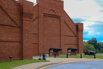
Long-term planning also incorporated access to the National Civil War Naval Museum area and Oxbow Meadows Environmental Learning Center.
Another phase extended the RiverWalk approximately three additional miles toward the Infantry Center at Fort Benning, now called Fort Moore.
Those extensions changed the scale of the project.
Instead of serving primarily as a downtown riverfront walkway, the RiverWalk became a longer recreational corridor linking multiple areas of Columbus.
| Development milestone | Confirmed detail |
|---|---|
| 1987–1988 | Planning begins in connection with sewer and water improvements |
| 1989 | Original construction begins |
| Oct. 12, 1992 | First one-mile section opens |
| Phase II | Total trail length reaches approximately 12 miles |
| Phase III | Approximately three additional miles toward Fort Benning |
| Phases IV–V | Northern extensions toward Bibb Mill and Lake Oliver |
| Current city description | 22-mile RiverWalk |
Source: Columbus Parks and Recreation. The city identifies the construction phases but does not provide a precise completion date for every extension.
The successive additions helped give the RiverWalk a purpose beyond downtown beautification. Residents could use it to reach recreational destinations while staying closer to the river.
The Northern Expansion Reaches Bibb Mill and Lake Oliver
Columbus eventually extended the RiverWalk north through another historically significant part of the city.
The city's Parks and Recreation Department identifies Phases IV and V as the northern extensions, continuing from the TSYS campus toward Bibb Mill and Lake Oliver.
Bibb Mill connects the trail with Columbus' industrial history. The same river that once supported textile manufacturing now provides the setting for a recreational route through former industrial areas.
The northern section also links the larger RiverWalk system with Lake Oliver, extending its geographic reach beyond the original downtown development.
Today, Columbus Parks and Recreation describes the completed RiverWalk as a 22-mile linear park with an asphalt trail and access for pedestrians, cyclists and other recreational users.
Visit Columbus, the city's official tourism organization, also uses the 22-mile figure.
Other publications still describe the Columbus RiverWalk as 15 or 16 miles. Those differences appear in older tourism descriptions and accounts of earlier development phases.
For this article, Columbus Times uses the 22-mile figure published by the city's current Parks and Recreation Department. The different published lengths should not be interpreted as proof that every source measures exactly the same route.
Phenix City Builds Its Own RiverWalk
While Columbus extended its trail along the Georgia side, Phenix City developed a corresponding recreational route on the Alabama bank.
The city's official tourism information describes the Phenix City RiverWalk as approximately 1.21 miles long, running north from the Phenix City Amphitheater along the western bank of the Chattahoochee.
The city says the historic Dillingham Street Bridge and the 14th Street Pedestrian Bridge connect it to the Columbus RiverWalk, and that the trail begins at an open-air amphitheater that seats 3,000.
Unlike the longer Columbus route, the Phenix City RiverWalk is concentrated along a relatively short section of downtown waterfront.
Its design incorporates cement, brick, boardwalk-style decking and iron bridges. The city also describes portions of the trail that use early-20th-century dam structures, creating elevated views of the river.
Phenix City's Parks and Recreation Department is responsible for trail maintenance, including lighting, benches, trash collection and water fountains.
The project gave the Alabama side of the river a public recreational facility that complemented Columbus' larger trail network.
The Bridges That Connect Two States
An important feature of the combined riverfront is the ability to travel between Columbus and Phenix City.
The 14th Street Pedestrian Bridge provides a connection between the two riverfront areas without requiring pedestrians and cyclists to use a bridge carrying ordinary automobile traffic.
Phenix City's comprehensive planning documents identify the bridge as a dedicated pedestrian connection between the cities.
The historic Dillingham Street Bridge provides another crossing between downtown Columbus and Phenix City.
These connections allow visitors to experience both riverbanks and help make the trails more useful as a regional recreational system.
The Phenix City side offers views across the river toward downtown Columbus, while the Georgia side provides access to additional recreational and commercial destinations.
This relationship is important because the RiverWalk developments were not isolated municipal projects. Together, they helped make the Chattahoochee a shared public destination.
2013: Dam Removal Changes the Riverfront Again
One of the largest changes to the riverfront came more than 20 years after the original RiverWalk construction began.
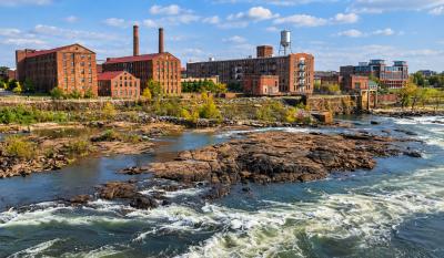
In 2013, a separate project supported by Uptown Columbus removed two former industrial dams and opened the river to modern whitewater recreation.
The dams had supported the area's historic textile industry. As manufacturing changed, community leaders pursued a plan to transform the river into an outdoor recreation destination.
According to an Uptown Columbus project report submitted to the International Downtown Association, the organization raised $26.3 million for the river restoration and whitewater project.
The work required approval from the U.S. Army Corps of Engineers, engineering design and arrangements for commercial whitewater operations.
The dam removal was completed in 2013.
The whitewater project was separate from the original sewer-related RiverWalk construction, but the two developments complemented one another.
Visitors could now use the existing riverfront trail to observe whitewater activity. The river itself also became a recreational attraction through rafting and kayaking.
Uptown Columbus subsequently developed additional outdoor amenities, including ziplines connecting Georgia and Alabama, a playground, a splash pad and expanded bicycle paths.
The combination helped shift the downtown riverfront toward recreation and tourism.
The RiverWalk Becomes Part of a Larger Downtown Revival
The riverfront's transformation occurred alongside other changes in downtown Columbus.
Columbus State University's downtown presence and the RiverCenter for the Performing Arts helped bring educational and cultural activity into the same general area.
The New Georgia Encyclopedia describes downtown revitalization as part of Columbus' broader economic and cultural development during the late 20th and early 21st centuries.
The same report identified new outdoor recreation facilities and visitor attractions as parts of Uptown's revitalization strategy.
Together, these developments changed how the riverfront served the community, adding recreation, tourism, cultural activities and public gathering spaces to an area historically associated with industry.
Phenix City's public RiverWalk information has described longer-term expansion concepts, including extensions north toward Highway 80, south toward State Docks Road and west toward a nature trail connection.
Those plans represent proposed improvements, not verified completed extensions.
The importance of maintenance became particularly clear in August 2024, when Phenix City announced a closure of the RiverWalk section under and around the 13th Street Bridge because of erosion.
The announcement said other sections remained open at that time. Columbus Times did not find a sufficiently current official notice confirming whether the affected section had reopened by October 2026.
Visitors should therefore check current city notices before assuming every portion of the Phenix City trail is accessible.
Where Can You Enter the Columbus RiverWalk Today?
Columbus Parks and Recreation identifies several entry points along the completed RiverWalk.
They provide access from downtown, public recreational areas and locations farther north along the Chattahoochee.
| RiverWalk access point | City-listed access |
|---|---|
| Bay Avenue and 11th Street | Downtown access |
| Front Avenue and Eighth Street | Stairs behind Space Center |
| Front Avenue and Sixth Street | Sidewalk |
| Golden Park | Stairs and sidewalk |
| Civic Center | Stairs |
| Rotary Park | On-site access |
| Rigdon Park | Sidewalk |
| 23rd Street | Sidewalk |
| Bibb Mill | Sidewalk |
| Hemlock Park | Sidewalk |
| Lake Oliver | On-site access |
The city provides a RiverWalk map through its Parks and Recreation website.
The RiverWalk is intended for public recreation and offers access to different sections without requiring visitors to travel its entire length.
What Are the Rules for Using the RiverWalk?
Columbus Parks and Recreation publishes rules intended to protect trail users and maintain the public space.
Motorized vehicles and swimming are prohibited on the Columbus RiverWalk. Children ages 11 and younger must be accompanied by an adult.
Pets must comply with leash laws, and owners are responsible for cleaning up after them. Alcoholic beverages are prohibited, and vending requires the appropriate permit.
Fishing is permitted, provided users follow the applicable rules and clean up their fishing areas.
The city also specifies that pedestrians have the right of way.
Visitors should check current local notices for closures or changes before planning a longer trip.
More Than Three Decades After Opening
The Chattahoochee RiverWalk reflects several generations of investment in the riverfront.
The original project addressed infrastructure needs, while subsequent phases connected recreational sites across Columbus.
Phenix City's development created a corresponding public pathway on the Alabama bank. The bridges between the two cities made the riverfront a shared destination.
Later, the whitewater project transformed another part of the river's purpose, adding outdoor activities to a location once defined largely by industrial use.
The scale of that change is clear when comparing the original one-mile opening in 1992 with Columbus' current 22-mile RiverWalk.
What began as an infrastructure improvement became a long-term public investment in how Columbus and Phenix City use the Chattahoochee.
The trail continues to provide a connection between the region's past and its present: from historic mill sites and downtown streets to parks, recreation facilities and riverfront attractions.
How We Did This
Columbus Times reviewed official Columbus Parks and Recreation records, Phenix City government documents, Visit Columbus tourism information, a University of Georgia archaeological report and a project summary prepared by Uptown Columbus.
Historical dates, project phases, trail lengths and financial figures were taken from the organizations' published records. We distinguished the original RiverWalk construction from the separate whitewater restoration project.
For Columbus' current trail length, we used the 22-mile figure published by Columbus Parks and Recreation. For Phenix City's RiverWalk, we used the city's published length of approximately 1.21 miles.
Proposed expansions were not presented as completed projects. Where current access conditions could not be confirmed, including the Phenix City erosion-related closure, the limitation is identified.
Source: Columbus Parks and Recreation; Phenix City; Uptown Columbus; University of Georgia; Visit Columbus
News organizations may republish this story with credit. See our guidelines.
Know someone who'd want to read this? Email it to a friend.
Own a Columbus business? 60,000+ page views a month. Ads from $125/month. See ad optionsPlan your weekend with Columbus Times
Get This Weekend in Columbus every Thursday: the best local events, free things to do and family fun, plus each evening's local news. Free, and you can unsubscribe anytime.
Most read this week
- 8 Columbus Restaurants Got a C on Their Health Inspection in 2026, the Most of Any Year Since 2022. Here's Every One
- Georgia's 3 Amendments: Which Will Pass, Who's Against Them, and What Happens If They Fail
- Georgia's 3 Constitutional Amendments on the Nov. 3 Ballot, Explained in Plain English
- Early Voting in Columbus Starts Oct. 13: Every Site, the Hours, and What's on Your Ballot
- The Night Fight on the Chattahoochee: How Columbus Became the Site of What Many Call the Last Battle of the Civil War
More stories
 Local Columbus vs. Augusta, Macon and Savannah: 15 Questions on Pay, Rent and Home Prices
 Local Columbus' 10 Biggest Chattahoochee River Floods Since 1841, Ranked by USGS Records
 Local The Night Fight on the Chattahoochee: How Columbus Became the Site of What Many Call the Last Battle of the Civil War
 Local Columbus Holds On to No. 2 in Georgia by Just 172 People, and Grows for the First Time Since 2020
Comments
Be respectful. No personal attacks, hate speech, spam or anyone's private information. Every comment is reviewed before it appears. Comment rules
No comments yet. Be the first to share your thoughts.